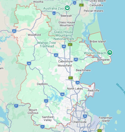
NCV Area Map
Our Northside Community Voices Area
Our area is defined as the City of Moreton Bay (CoMB).
That definition is subject to a minor boundary change approved by the Board and required to be ratified at the next General Meeting and approved as a minor change to the Constitution by the Office of Fair Trading that deletes the areas of State Government electorates that lie outside the boundary of CoMB.
That definition currently includes the following political jurisdictions:
1. Local Government Divisions of the City of Moreton Bay – some suburbs are split between one of more divisions, but the table below shows which suburbs have been allocated into each division for the purposes of NCV operations:
.
Division 1
Beachmere
Donnybrook
Elimbah
Godwin Beach
Meldale
Ningi
Sandstone Point
Toorbul
Division 2
Burpengary
Burpengary East
Morayfield
Narangba
Division 3
Bellmere
Caboolture
Caboolture South
Moodlu
Division 4
Griffin
Mango Hill
North Lakes
Division 5
Deception Bay
Kippa-Ring
Newport
Rothwell
Scarborough
Division 6
Clontarf
Margate
Redcliffe
Woody Point
Division 7
Dakabin
Kallangur
Murrumba Downs
Division 8
Bray Park
Joyner
Lawnton
Petrie
Strathpine
Division 9
Brendale
Cashmere
Clear Mountain
Eatons Hill
Warner
Division 10
Albany Creek
Arana Hills
Bunya
Draper
Everton Hills
Ferny Hills
Division 11
Armstrong Creek
Camp Mountain
Cedar Creek
Closeburn
Dayboro
Highvale
Jollys Lookout
King Scrub
Kobble Creek
Kurwongbah
Laceys Creek
Mount Glorious
Mount Nebo
Mount Pleasant
Mount Samson
Ocean View
Rush Creek
Samford Valley
Samford Village
Samsonvale
Whiteside
Wights Mountain
Yugar
Division 12
Booroobin
Campells Pocket
Cedarton
Commissioners Flat
D’Aguilar
Delaneys Creek
Elimabah
Mount Delaney
Mount Mee
Neurum
Stanmore
Stony Creek
Upper Caboolture
Wamuran
Wamuran Basin
Woodford
2. State Government Electorates of:
The current state electoral boundaries are listed below:
- Aspley
- Bancroft
- Everton
- Ferny Grove
- Glass House
- Kurwongbah
- Morayfield
- Murrumba
- Pine Rivers
- Pumicestone
- Redcliffe
The State Government electorates of Everton, Ferny Grove and Glass House include areas that lie outside the boundary of CoMB.
Under changes proposed by the Queensland Electoral Commission the boundaries that will probably apply for the 2028 election are described below.
The creation of the new district of Caboolture in this region has enabled the Commission to reduce the number of electors in the surrounding districts, bringing the district of Murrumba back into quota. The new district, situated west of the Bruce Highway, includes the central portion of the Caboolture locality, and expands west with the D’Aguilar Highway as its core transport spine. Pumicestone and Deception Bay (formerly Bancroft) have shifted east, strengthening their character as districts shaped around the area’s northern coastal communities.
The Commission notes this region is expected to continue to experience strong growth in the coming years. The proposed district of Morayfield is one of 5 districts expected to exceed the quota by 2032 on account of significant ongoing development.
NCV’s main focus is upon the 8 districts that have now been named in the Moreton Bay area: Pine Rivers, Kurwongbah, Murrumba, Redcliffe, Deception Bay, (formerly Bancroft) Morayfield, Pumicestone and Caboolture (new).
On the southern edge of our area, some CoMB suburbs have now been included in other state electorates, including – Jollys Lookout (Ashgrove) Ferny Hills and Arana Hills (Ferny Grove) and Everton Hills (Everton).
3. Federal Government Divisions of:
- Dickson
- Longman
- Petrie
Note:
The names and boundaries of the State and Federal seats are subject to change with redistributions that are expected as the population of our area grows. NCV will make the necessary boundary changes as and when these changes occur.